

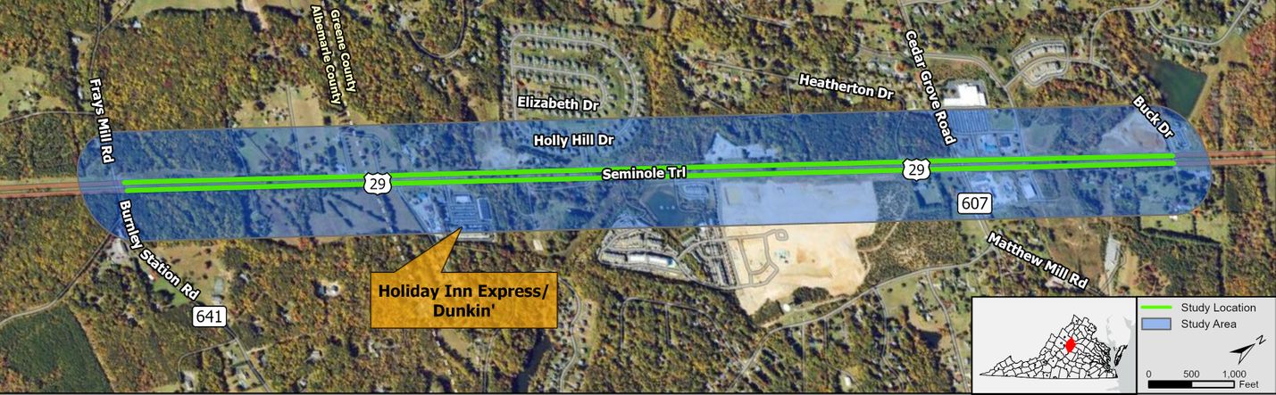
Route 29 (Seminole Trail) from Route 607 (Matthew Mill Road/Cedar Grove Road) to Route 641 (Frays Mill Road/Burnley Station Road), Albemarle and Greene counties
Study Purpose
The study area includes Route 29 (Seminole Trail) from Route 607 (Matthew Mill Road/Cedar Grove Road) to Route 641 (Frays Mill Road/Burnley Station Road) in Albemarle and Greene counties. The purpose of the study is to identify improvements throughout the corridor, including the intersections of Route 29 with Matthew Mill Road/Cedar Grove Road and Frays Mill Road/Burnley Station Road, that will also consider anticipated development in the area and Greene County's proposed Route 670 Connector. The focus is on:
- Improving safety
- Keeping traffic flowing
- Reducing congestion
- Enhancing commuting options (such as carpool, vanpool, Park and Ride, or transit programs that could reduce solo driving)
- Improving pedestrian safety and
- Improving access for cyclists and transit riders.
The study will assess short-term, mid-term, and long-term challenges and opportunities and will identify project recommendations that can be advanced for future local, state, and federal funding opportunities. The study will not set construction dates for any of the alternatives.
Study Partners
- Albemarle County
- Greene County
- Thomas Jefferson Planning District Commission
- JAUNT
Key Points of Contact
District Lead: Charles Proctor and Sandy Shackelford
Lead Consultant: Andy Nagle and Alex Shoemaker
Schedule
Start date: September 2026
End date: April 2028
Last updated: November 4, 2026
